Trail Walking La Boissière-de-Montaigu - La Mazure - Photo
© OpenStreetMap contributors
Length
Length
10.2 km
Max alt
Max alt
75 m
Uphill gradient
Uphill gradient
119 m
Km-Effort
Km-Effort  
11.8 km
Min alt
Min alt
39 m
Downhill gradient
Downhill gradient
119 m
Boucle
Boucle
Yes
Creation date :
2014-12-10 00:00:00.0
Updated on :
2014-12-10 00:00:00.0

(0 Reviews)

Walking
Walking
2h30
Difficulty : Easy

Scan this QR Code to open this trail in the SityTrail application

FREE GPS app for hiking

Logo SityTrail SityTrail

IGN / Geographical institutes

Download SityTrail from the App Store Download SityTrail from Google Play

Logo SityTrail SityTrail World

The world is yours!

Download SityTrail from the App Store Download SityTrail from Google Play Download SityTrail on Huawei AppGallery

About

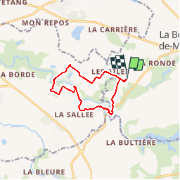
Trail Walking of 10.2 km to be discovered at Pays de la Loire, Vendée, La Boissière-de-Montaigu. This trail is proposed by neoroll44.

Description

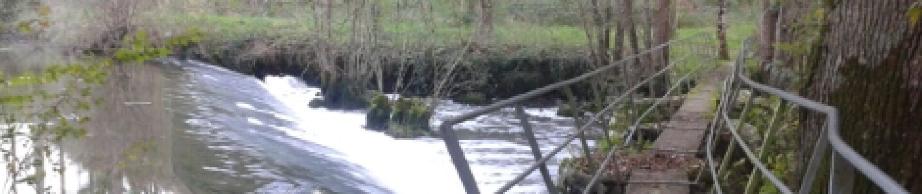
Depuis le camping de l'Eden, le tour du château de la Mazure en traversant la Grande Maine sur un passerelle ancienne.

Elevation profile

Photos

Positioning

Country:
France
Region :
Pays de la Loire
Department/Province :
Vendée
Municipality :
La Boissière-de-Montaigu
Location:
Unknown
Start:(UTM)
635532 ; 5199851 (30T) N.

Trails nearby

Trail Walking  - Pont Lege  -  Saint Fulgent - Photo
Walking
yves le sommer

Walking

Difficult
, Pays de la Loire, Vendée, France
14.2 km | 16 km-effort
3h 36min
No
Trail Walking La Boissière-de-Montaigu - La Bultière - Photo
Walking
neoroll44

Walking

Medium
(1)
La Boissière-de-Montaigu, Pays de la Loire, Vendée, France
11.1 km | 12.6 km-effort
3h 0min
Yes


Close
My subscriptions